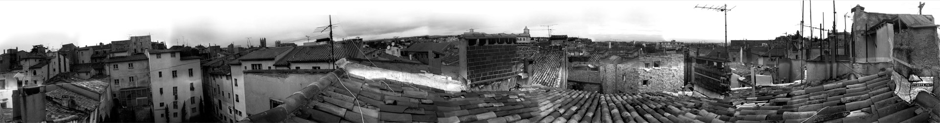
https://www.atlasofplaces.com/research/infrastructure-patterns-i/
https://www.atlasofplaces.com/research/infrastructure-patterns-vii/

Atlas of Places is a public educational collection of Academia, Architecture, Cartography, Cinema, Essays, Painting, Photography and Research. Its objective is to question the meaning of places. It is curated according to continuously evolving philosophical, social and cultural beliefs. This is merely an occasional collection. Some works date from 1230, some from the recent past, some from the present. They have this characteristic in common that they are outlooks, in the truest sense of the word. In them will be found little more than the intention of clarifying a few ideas that might really be called political if that fine word, so attractive and exciting to the mind, did not arouse today so many great scruples and great repugnance.
Atlas of Places simply wishes to make a little clearer to itself the notions that it has received from others or that, like others, it has formed for itself — notions that everyone uses for thinking about human groups, their relations and difficulties with one another. The effort to clarify such matters is assuredly not the business of those men who practice or mix in them. This collection is the work of an amateur.
Atlas of Places is dedicated to those persons who have no system and belong to no party and are therefore still free to doubt whatever is doubtful and to maintain what is not.
Atlas of Places is curated day by day, the works shared do not pretend to show any organic development: the link between them is rather one of insistence and repetition. For while one doesn’t know whether things which are repeated are pleasing, one’s belief is that they are significant. And what is sought throughout this collection are significant features.
Atlas of Places produces cartography, satellite imagery and orthoimagery for exhibitions, editorial projects and various other mediums. This continuous production appears in the Research collection. If you wish to collaborate, please scroll down to the “Collaboration” section below.
Atlas of Places originated in the Pyrénées-Orientales during the summer of 2015 and is edited by Thomas Paturet.

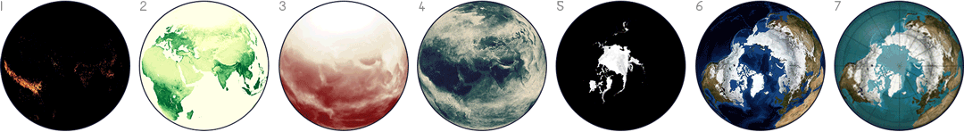
NASA publishes many Earth datasets at monthly time scales, and this GIF uses one frame per month to show the fluctuating seasons. The animation focuses mainly on data about Arctic sea ice and vegetation, but it was hard to choose - NASA has many other beautiful seasonal datasets, like fire, temperature, or rainfall.

The Electricity Map is developed and maintained by Tomorrow, a small Danish/French start-up company. Our goal is to help humanity reach a sustainable state of existence by quantifying, and making widely accessible, the climate impact of the daily choices we make.
Histomap: a visualization of 4000 years of History, created in 1931 by John B. Sparks.


All three maps continue reasonate with me. The first offers us a stategic overlay. Which countries are powers/maintainers of the international system – which places are seeking to radical alter it, or cannot seem to become part of the core.
The second shows the virtual implications of that gap. Here, the gap between core and periphery is made starkly clear in technology use.
The final shows the physical manifestation of the gap. A stark reminder of the fences we build and the enormous sums of money and energy poured into keeping certain people out.
As a final note, I do think the third map is slightly misleading. As disturbing as it is, it is actually far, far too flattering to many traditional western powers as it continues to place them at the “centre.” In a world where the United States appears to be in decline this type of map makes China, Brazil, India and Russia (and even South Africa) look like non entities. Nothing could be further from the truth.
HyperCities makes possible for geographic maps to seamlessly merging the historical representations of the city in their current situation, and thus connecting the digital archives, maps, and stories with the physical world.
The Atlas of True Names reveals the etymological roots, or original meanings, of the familiar terms on today's maps of the World, Europe, the British Isles and the United States.
More than any time in the history of the Web, incumbents in the network economy are consolidating their power and staking new claims to key points of control. Welcome to the first iteration of the Web 2.0 Summit's theme, Points of Control!
Abstraction today is no longer that of the map, the double, the mirror or the concept. Simulation is no longer that of a territory, a referential being or substance. It is the generation of models of a real without origin or reality: a hyperreal.